Neele's Nightmare
|
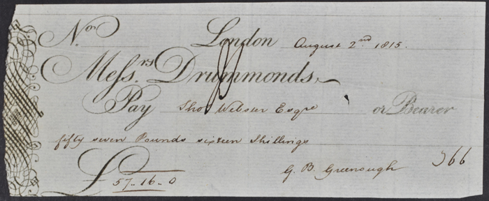
Cheque for £57 16s made out to Thomas Webster from George Bellas Greenough, for 53 days’ worth of drawing services charged at £1 1s per day. Webster was paid £204 13s in total for designing the base map. Greenough collection, ref: LDGSL/947/5/1/1
|
To oversee the production of the Society’s map a new Map Committee was formed, this time including Greenough. Originally the idea was to adapt an existing topographical map. The option of using the map of the leading cartographer John Cary was clearly out of the question as he was producing William Smith’s version. His close rival Aaron Arrowsmith (1750-1823) was approached instead but the accuracy of the topography on his maps could be variable. This led to the offer of re-engraving the map to suit the Society’s needs. The cost for the engraving was to be £900, with Arrowsmith estimating that it should be completed by the end of 1814. This was a problem as the total budget was £1000 which was to cover the entire costs of the map’s production. Arrowsmith’s offer was rejected. Instead the Society decided to commission its own map.
The Society’s draughtsman Thomas Webster produced an outline map which was ready to be engraved by the end of 1814. The cartographer Samuel J Neele (1752-1824) won the contract to engrave the new map. He estimated that the cost of engraving the outline map as it stood would be no more than £105. Lettering, topography and other features would be extra.
|
|
|
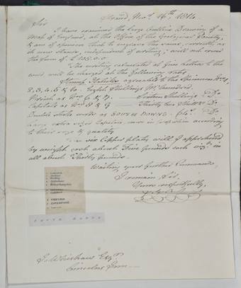
L: Interested parties were invited to view the drawing at the Society’s apartments and submit estimates with examples of their work. This is Neele’s estimate with an example of his engraving work for various letter forms.
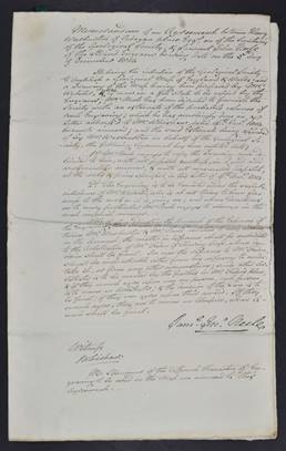
R: Contract with Neele for engraving the first stage outline map, dated 5 December 1814.
Greenough collection, ref: LDGSL/947/5/1/1. Click to enlarge
|
|
|
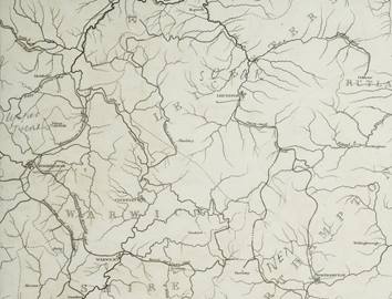
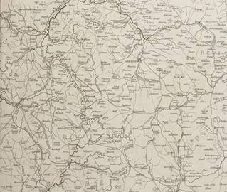
Detail of the area around the Midlands from the earliest surviving proof of the new base map for Greenough’s 'Geological Map of England and Wales', [1816]. Greenough collection, ref: LDGSL/947/5/1/4. Click to enlarge.
|
The same area taken from a proof from April/May 1818, showing the addition of more place names but still no topography. Greenough collection, ref: LDGSL/947/5/1/6. Click to enlarge.
|
|
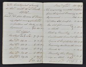
Notebook kept by Samuel Neele detailing a running cost of the engraving, proof printing and subsequent modifications made to the production of the base map, June 1815-April 1819. Greenough collection, ref: LDGSL/947/5/1/1. Click to enlarge
|
Greenough’s determination to have the perfect base map slowed down the production process and caused the costs to balloon. Place names and chemical symbols were added and removed again, with changes so frequent that some of the copper plates had to be repaired after nearly being destroyed through being re-engraved so often.
It would take nearly five years to produce the base map, costing £1234 12s 6d. Of this £204 13s was paid to Webster for drawing the map, the rest was given to Neele. Engraving of the 'Marshes and Hills' and 'Mountains' were an additional £156 and £450 respectively. The copper for the plates was £38 9s 9d and paper £73 10s. This left £206 7s which was the cost for corrections and proofs.
Printing, colouring and advertising brought the official estimated total, presented to the Geological Society’s Council in January 1820, to £1720. The equivalent of around £100,000 today.
The subscribers who had pledged the original £1000 budget had been released from their promises in order to fund the move to the Society’s new premises at Bedford Street in 1816. Instead the costs for the new map were paid for by Greenough and his friend and fellow Map Committee member Henry Warburton (1784-1858). Greenough calculated that by March 1820 he had paid £677 17s 6d out of his own pocket. Warburton’s contributions were far higher, estimated to be around £1000. Any profits from sales of the map were to be used in the first instance to repay the two men.
<<Back to main page
Next: Mission Accomplished>>