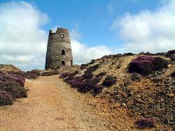
Or perhaps just a nasty hole waiting for folk to fall down it? The search is on to find the oldest mine map in the UK, says Adler deWind
Geoscientist Online 10 March 2010
As part of ongoing work to create a national Mining Plans Portal, the British Geological Survey (BGS) is asking the geologists: do you have the oldest mine plan in Great Britain?
There has been mining in Great Britain for approximately 5000 years. However, despite this long heritage, the earliest detailed maps, known as mine plans, are only as recent as the 18th Century. One of the earliest mine plans on record is from the Esgair-Hir lead and silver mine in Cardiganshire, dated 1704.
Richard Shaw, BGS geologist said: “It is only since 1872 that mine owners have been obliged to deposit plans of abandoned workings with the Mining Records Office. There are more mine plans in existence than have ever been officially deposited and the BGS is actively seeking information on mine plans for minerals other than coal, such as lead and zinc, which may exist in these private collections. The BGS is particularly keen to discover mine plans that are older than those held in official collections.”
The voids caused by underground mining activity may pose a potential hazard, to both life and assets and the risk of ground movement can reduce property values. Further, mineral workings and associated spoil can frequently cause a pollution hazard. Mining records can also provide important cultural information on the distribution and past extraction of mineral resources and are a key source of information for geological surveying and scientific research.
A variety of official collections, catalogues and indexes of non-coal mine plans exist in public hands but these, individually, cover only part of the total holdings thought to be in excess of 40 000 documents. The majority of coal plans are held by the Coal Authority.
In 2002 the Mining Information Group was formed; the Health and Safety Executive, The National Archives, The Coal Authority, the British Geological Survey, the Mineral Valuer, and the Camborne School of Mines agreed to create a national database of non-coal mine plans and sections. This led to the creation of the Mining Plans Portal (
www.bgs.ac.uk/nocomico).
The Mining Plans Portal provides information on mines via both a searchable online map and database. The portal is regularly updated and mine plans are actively sought. Mine plans exist whose location has not been identified; information on the location of these plans is also welcomed.
Neville Hill of the HSE Mines Inspectorate, Mining operations Policy said: "HSE endorses continued work by the Mining Information Group to update and increase information and knowledge about our mining legacy. We remain committed to supporting development of the Mining Plans Portal, having the best possible information assists the safety of all possible future mine workings and other developments".
Mining Plans Portal
The Mining Plans Portal is a partnership of public sector bodies who have come together to make information about the extent of historic underground mining of non-coal minerals in Britain more accessible. The aim of the portal is to make information about underground mining records available directly, as well as provide guidance on organisations that can provide more detailed information. More at
www.bgs.ac.uk/nocomico.