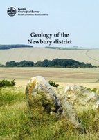
Geology of the Newbury District – A Brief Explanation of 1:50,000 Geological Map Sheet 267

D T Aldiss, A J Newell, N J P Smith & M A Woods
Published by: British Geological Survey
Publication date: 2006
ISBN: 085272533-7 (explanation); 075183454-8 (map)
List price: £18.00
34 pp
www.bgs.ac.uk
The new map sheet and explanation is a very welcome and long overdue update of the 1898 (Hungerford) map sheet and 1907 memoir, and is the result of a new 2000-2003 survey.
The district contrasts rolling, grass covered chalk downs, with wooded hills and alluvial terraces and floodplains. The profusion of flints as building stones, the flint gravel washed across the highways and byways by springs and rainwater, the white Cretaceous chalk mud that glues itself to boots and walking shoes on the ‘downs’, and the gravely and pebbly Palaeogene sands of the wooded ‘commons’ define the nature of the geology.
It comes as a surprise then to find a map of Chalk downland with a stratigraphic column going down through the Quaternary, Tertiary and Cretaceous sediments into the unseen Triassic, Carboniferous, Devonian and even the Lower Palaeozoic. In the last 100 years not only have there been Tertiary and Cretaceous stratigraphic revisions, but also a wealth of new direct (borehole) and indirect (reflection seismic, magnetic and gravity) data to advance understanding of southern England deep geology. Map sections are projected over 2kms downhole and explanations given based on geophysical responses and deep drilling of the buried Berkshire Coal Basin, Lower Palaeozoic volcanics, south dipping Variscan thrust ramps and Westphalian basalts and microgabbros.
It is almost an anticlimax to reach Page 8 of the explanation and read about the familiar outcropping sediments actually seen around the district. Even here life has become more complicated, but no less interesting, as revised stratigraphic terminologies and descriptions are presented for the Cretaceous Chalk Group, which directly underlies most of the map sheet, and the overlying Tertiary and Quaternary sediments. The sub-Palaeogene residual clay-with-flints (much disliked by local gardeners!), the Quaternary periglacial head (solifluction) deposits and nine alluvial terraces complete the superficial geology.
Past mineral extraction has been limited to various chalk resources, flints for building and clay and sand for brick and tile manufacture. The peaceful rural setting is challenged only by the effects on newly constructed homes of instability of backfilled chalk pits, chalk solution and the slumping of water saturated Tertiary sediments.
Map and explanation front covers show a very typical view of the area, with downland minus the crop circles, but with silicified Palaeogene ‘sarsen’ sandstones much used in the Neolithic stone circles. The authors have succeeded admirably in producing a very informative and well illustrated summary to a long awaited and equally informative map with sections.
Chris Carlon